On this page
Deep beneath the Amazon’s thick canopy, laser scans have uncovered a network of massive geometric earthworks that point to a forgotten civilization far larger than scholars once imagined. These findings reshape our understanding of how ancient peoples lived, farmed, and gathered in the rainforest.
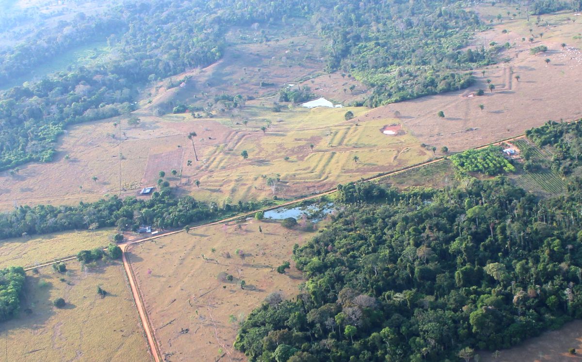
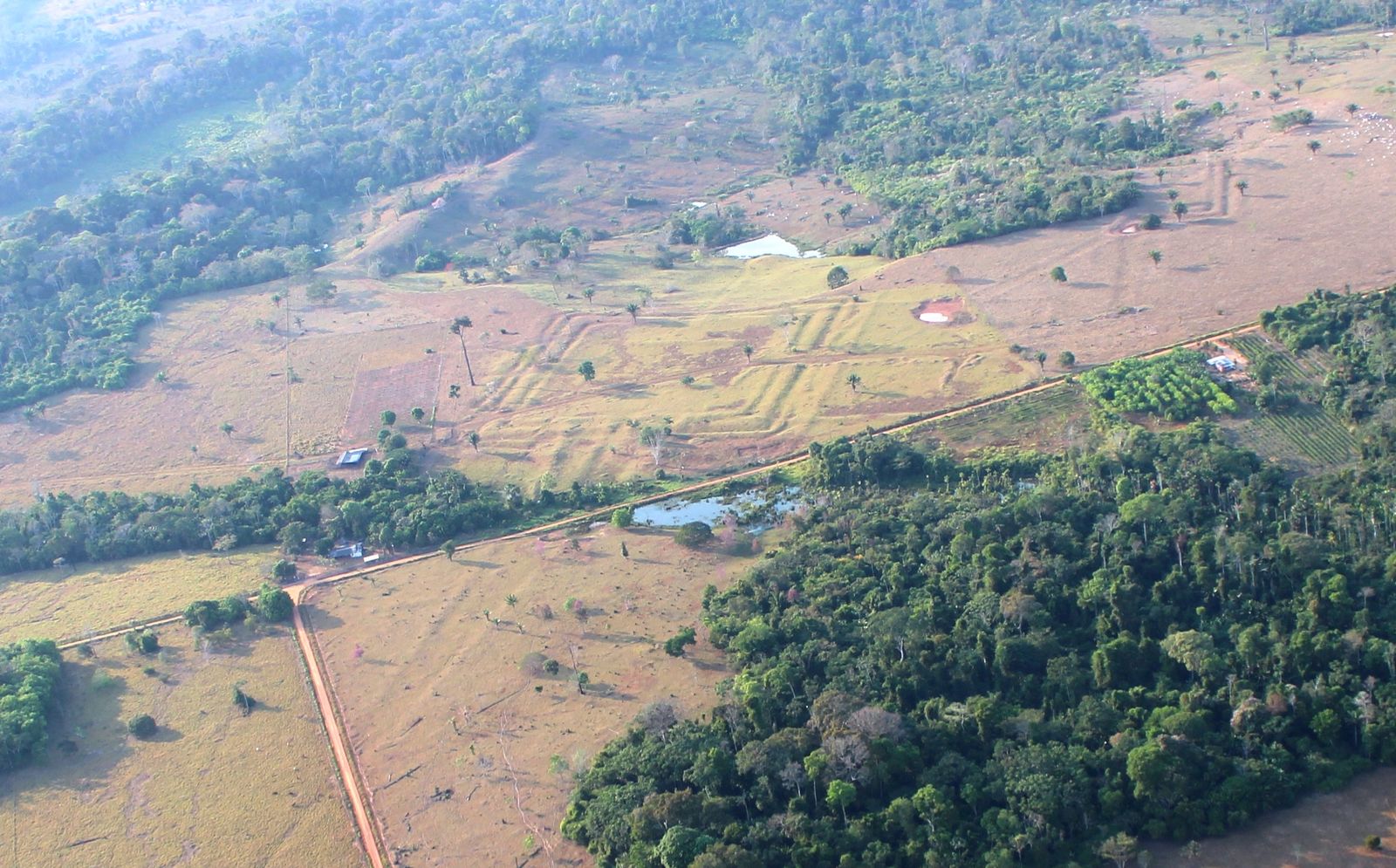
Discovery of the Aquiry Geoglyphs
Archaeologists first noticed unusual patterns in satellite imagery and decided to fly a lidar sensor over a 1,740‑square‑mile swath of northern Brazil. The laser pulses penetrated the dense foliage and returned precise elevation data, exposing nearly 400 geometric earthworks that had been invisible from the ground. These features, dubbed “geoglyphs,” consist of deep ditches flanked by high embankments arranged in circles, squares, octagons and more complex designs. The discovery was reported in a peer‑reviewed paper published in Nature on July 29, 2026 (source).
How Lidar Revealed the Hidden Shapes
Lidar works by emitting rapid laser pulses from an aircraft and measuring the time it takes for each pulse to bounce back. Because the beams can pass through gaps in leaves, they create a three‑dimensional map of the terrain underneath the canopy. In the Amazon survey, the data showed subtle depressions and raised ridges that matched the outlines of human‑made ditches and embankments. By analyzing the size and spacing of these features, researchers could estimate how much labor went into building them and how many of each site.
Why This Matters
The traditional view of the Amazon as an untouched wilderness is being overturned by evidence of large‑scale earthworks. The Aquiry geoglyphs demonstrate that pre‑Columbian societies engineered the landscape on a scale comparable to other ancient civilizations. Recognizing this human legacy helps scientists better understand past climate interactions, agricultural practices, and the true population potential of the rainforest before European arrival.
Scale and Significance of the Civilization
Based on the density of the newly found geoglyphs, scholars estimate that the Aquiry civilization covered more than 70,600 square miles—about the size of North Dakota—and may have housed between 1.25 million and 3 million individuals. Most earthworks average seven acres, with the largest stretching to 123 acres, featuring ditches up to 40 feet wide and 16 feet deep. Remarkably, these monuments were constructed without metal tools or draft animals, relying solely on human labor and organized community effort.
Daily Life and Culture of the Aquiry
Settlements likely consisted of villages of roughly 300 people living in multi‑family longhouses. Agriculture centered on squash, maize, manioc, Brazil nut trees and peach palms. The geometric plazas appear to have served as venues for ceremonies, political gatherings, feasts, dances, music, athletic contests and ball games. Such communal spaces imply a complex social hierarchy and shared cultural practices that persisted for centuries before the sites were abandoned between 850 and 950 C.E.
Worth noting
This point stands on its own and does not need extra caveats to be useful.
The Mystery of Their Decline
Researchers do not yet know why the Aquiry geoglyphs fell out of use, but the abandonment coincides with a broader period of upheaval that affected the Maya, Tiwanaku and Wari societies. Some hypotheses point to environmental shifts, changes in trade networks, or internal social stress. The relatively rapid decline suggests a tipping point rather than a gradual fade, prompting further investigation into what triggered the collapse of this rainforest‑based civilization.
Worth noting
What to Do Next
For readers intrigued by hidden histories, the next step is to follow ongoing lidar projects in other under‑explored parts of the Amazon. Supporting research institutions that publish open‑access data helps expand the map of ancient earthworks. Additionally, visiting museums with exhibits on Amazonian archaeology or watching documentaries that explain lidar techniques can deepen appreciation for how modern technology reveals forgotten pasts.
Want more practical guides? Explore more Ayxworks insights and save this article for later.
FAQ
What are geoglyphs?
Geoglyphs are large designs or motifs created on the ground, often by arranging stones, digging ditches, or building up embankments. In the Amazon, they take the form of geometric shapes such as circles, squares and octagons.
How does lidar see through trees?
Lidar sends laser pulses from an aircraft; the light can penetrate small gaps in foliage and reflect off the ground below. By timing the return signals, a detailed elevation model of the terrain is produced, revealing hidden features.
Did the Aquiry use metal tools?
No. The evidence indicates that the earthworks were built using only stone, wood and human labor, without metal implements or domesticated animals for haulage.
How many people might have lived in the Aquiry region?
Based on the density of geoglyphs and average village size, researchers estimate a population between 1.25 million and 3 million individuals.
Why did the Aquiry civilization disappear?
The exact cause is unknown, but the abandonment around 850‑950 C.E. coincides with declines in other contemporary societies, suggesting possible environmental or social factors that triggered a rapid collapse.